
How GPS Knows Exactly Where You Are
Open a map on your phone and a small blue dot appears almost immediately. Walk down the street and the dot moves with you. Start driving and your phone can determine not only where you are but which direction you are traveling, how quickly you are moving, when you have missed a turn, and approximately when you will reach your destination.
It feels as though your phone is somehow being watched from space.
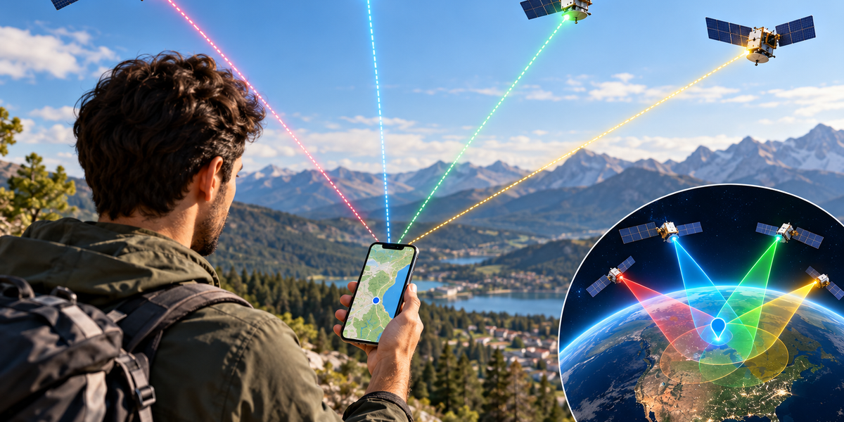
That is not actually how GPS works. GPS satellites do not normally track your phone, and your phone does not need to send its location to those satellites. Instead, satellites continuously broadcast extremely precise signals toward Earth. Your phone listens to several of those signals and uses their timing to calculate its own position.
The basic idea is simple. If you know exactly where several satellites are and can determine how far away you are from each of them, mathematics can reveal where you must be.
Making that calculation accurately, however, requires satellites, atomic clocks, radio signals, orbital information, sophisticated receivers, and some remarkable physics.
What GPS Actually Is
GPS stands for Global Positioning System. It is a satellite-based navigation system originally developed by the United States and now used around the world for navigation, timing, surveying, transportation, agriculture, emergency services, scientific research, and countless other applications.
The system relies on a constellation of satellites orbiting Earth. These satellites continuously transmit radio signals containing precise timing information and information about their positions.
A GPS receiver, such as the one inside your smartphone, can detect those signals and use them to calculate its location.
Importantly, ordinary GPS positioning is primarily a one-way process. The satellites broadcast signals, and your phone receives them. The GPS satellite does not need to know who you are or where you are located for your phone to calculate its position.
That distinction is important because GPS itself is fundamentally a positioning system, not a tracking service.
GPS Starts With Extremely Accurate Time
The secret behind GPS is time.
Radio signals travel at approximately the speed of light. That means that if your phone can determine how long a signal took to travel from a satellite to your device, it can estimate how far away that satellite is.
The basic relationship is familiar from school physics: distance equals speed multiplied by time.
The problem is that light travels incredibly fast. A tiny timing error can therefore produce a large positioning error.
GPS satellites solve part of this problem by carrying extremely accurate atomic clocks. Their transmissions contain precise timing information that receivers can compare with when the signals arrive.
By measuring the travel time of signals from several satellites, your phone can estimate its distance from each one.
One Satellite Is Not Enough
Suppose a satellite tells your phone that it is approximately 20,000 kilometers away.
That does not reveal your exact location. You could theoretically be anywhere on a huge sphere surrounding that satellite.
Now suppose a second satellite provides another distance measurement. Your possible locations become much more limited because you must be positioned somewhere that satisfies both measurements.
A third satellite narrows the possibilities further.
This process is commonly described using the concept of trilateration. Rather than determining your location primarily by measuring angles, the receiver determines distances from known reference points.
In three-dimensional space, additional information is necessary, particularly because the clock inside your phone is nowhere near as accurate as the atomic clocks aboard GPS satellites.
That is why GPS receivers normally use signals from at least four satellites to calculate a full position and correct their own clock error.
Why the Fourth Satellite Matters
If your phone contained an atomic clock as accurate as those on GPS satellites, positioning would be somewhat simpler. Unfortunately, atomic clocks are far too expensive and impractical to place inside ordinary smartphones.
Your phone’s internal clock contains small inaccuracies.
That might sound insignificant, but GPS calculations are so sensitive to timing that even a tiny error can translate into a substantial distance error.
A fourth satellite gives the receiver enough information to solve for another unknown: the difference between the phone’s clock and GPS time.
The receiver can therefore calculate latitude, longitude, altitude, and its own timing correction.
In practice, phones often receive signals from more than four satellites. Additional measurements can improve reliability and accuracy.
How Does Your Phone Know Where the Satellites Are?
Knowing how far away a satellite is only helps if you also know where that satellite is located.
GPS satellites therefore transmit information about their orbits and positions as part of their signals.
Your receiver uses this information together with the timing measurements to determine where each satellite was when its signal was transmitted.
The satellites’ orbits are carefully monitored, and ground-control systems help maintain accurate information about their positions and clocks.
Your phone is therefore solving a giant geometry problem in real time. It knows where several satellites are supposed to be, estimates its distance from each one, and finds the point in space that best fits those measurements.
The Satellites Are Constantly Broadcasting
GPS does not work like a phone call where your device contacts a satellite and asks, “Where am I?”
The satellites continuously broadcast navigation signals whether anyone is listening or not.
Your phone’s GPS receiver simply listens.
This is why millions of GPS receivers can use the system simultaneously without each one needing a separate communication channel with the satellites.
A satellite can broadcast the same signal across a large portion of Earth, and countless receivers can independently use that information to calculate their own positions.
The GPS system does not become overloaded simply because millions of additional phones open a map at the same time.
GPS Satellites Are Very Far Away
GPS satellites orbit Earth at an altitude of roughly 20,000 kilometers, far above the satellites used for some other purposes.
From that altitude, each satellite can cover an enormous portion of the planet.
The constellation is arranged so that receivers with a reasonably clear view of the sky can usually detect several satellites simultaneously.
Your phone does not necessarily use the same satellites throughout the day. As satellites move through their orbits and you move across Earth’s surface, different combinations become visible.
The receiver continuously updates its calculations using whichever suitable signals are available.
Your Phone May Use More Than GPS
When people say their phone is “using GPS,” the device may actually be using several satellite navigation systems.
GPS is the American system, but other global navigation satellite systems exist. Galileo is operated by the European Union, GLONASS was developed by Russia, and BeiDou is operated by China. There are also regional satellite navigation systems.
Modern smartphones can often receive signals from multiple constellations.
Using more satellites gives the phone additional measurements and can improve availability and accuracy, particularly in challenging environments.
The broader technical term is GNSS, or Global Navigation Satellite System. GPS is one GNSS, although the word GPS has become the everyday term people use for satellite navigation in general.
Why GPS Works Better Outdoors
Satellite signals have traveled more than 20,000 kilometers before reaching your phone, and by the time they arrive at Earth’s surface, they are relatively weak.
A clear view of the sky therefore helps enormously.
Outdoors, your phone can often receive signals from many satellites directly. Inside a large building, underground parking garage, tunnel, or subway system, satellite signals may become weak or disappear entirely.
Dense urban environments create another problem. Tall buildings can block signals or cause them to bounce off surfaces before reaching your phone.
This can make the receiver believe a signal traveled farther than it actually did, reducing positioning accuracy.
That is why the blue dot on your map may occasionally jump to the wrong side of a street when you are surrounded by tall buildings.
Your Phone Uses More Than Satellites to Find You
Smartphones do not rely exclusively on satellite navigation.
They combine information from multiple sources to determine location quickly and reliably.
Nearby Wi-Fi networks can provide useful location clues. Cellular towers can help estimate a device’s general position. Accelerometers and gyroscopes can detect movement, while a magnetometer can help determine direction.
The phone can combine these sources using sophisticated software.
If satellite signals temporarily become unreliable while you pass between tall buildings, other sensors can help the phone estimate how you are moving until better satellite information becomes available again.
This process is often called sensor fusion.
The location shown on your phone is therefore frequently the result of several technologies working together rather than one GPS calculation.
Why Your Phone Finds You Faster Than a Standalone GPS Receiver Sometimes Did
Early GPS devices could take a noticeable amount of time to determine their position, particularly when first switched on.
A receiver needs information about satellites and their orbits before it can calculate a location efficiently. Receiving all of that information directly through relatively slow satellite signals can take time.
Smartphones can speed up the process using Assisted GPS, commonly called A-GPS.
Because your phone is connected to cellular networks or Wi-Fi, it can obtain useful information about satellite locations and approximate time through internet-connected services rather than waiting to receive everything from the satellites themselves.
The phone may also already have an approximate idea of its location from cellular or Wi-Fi information.
Instead of beginning with absolutely no idea where on Earth it is, the device can start with useful clues and refine the result using satellite signals.
How Accurate Is GPS?
For ordinary consumer devices under good conditions, satellite positioning can often determine location within several meters.
Accuracy can improve or worsen depending on the environment, receiver quality, number and arrangement of visible satellites, atmospheric conditions, interference, and the navigation technologies being used.
Professional surveying systems can achieve dramatically greater precision by using specialized equipment and correction techniques.
This means there is no single universal “GPS accuracy.” The same fundamental satellite systems can support everything from ordinary smartphone navigation to extremely precise scientific and engineering applications.
For finding a café or navigating along a road, several meters of accuracy is usually more than enough.
Why Your Location Sometimes Drifts
If you leave a map open while standing still, you may notice that your location marker moves slightly even though you have not moved.
This happens because positioning measurements contain small errors.
Radio signals can be affected by the atmosphere. Signals can reflect from buildings. Satellite geometry changes. The receiver itself has measurement limitations.
Each new position calculation may therefore produce a slightly different answer.
Software attempts to smooth these changes and combine them with motion sensors to produce a stable estimate, but small variations are unavoidable.
Your phone is not actually claiming to know your location with infinite precision. It is continuously calculating the most likely location based on imperfect measurements.
How GPS Knows Which Direction You Are Going
GPS can determine movement by comparing your position over time.
If your calculated position moves north over several measurements, the receiver can determine that you are traveling north. Changes in position can also be used to estimate speed.
When you are standing still, however, GPS alone may have difficulty determining which direction the phone is facing because your position is not changing enough.
That is where other sensors become useful.
A smartphone’s magnetometer acts as a digital compass, while its gyroscope and accelerometer provide information about orientation and movement.
Navigation apps combine these measurements so the map can determine not only where you are but which direction the phone is pointing.
How Your Phone Calculates Your Speed
GPS can provide surprisingly accurate speed measurements under suitable conditions.
Instead of relying on rotating wheels like a traditional vehicle speedometer, a GPS receiver can determine how its position changes over time and can also use characteristics of the satellite signals themselves to estimate movement.
Because satellite timing is extremely precise, GPS-based speed measurements can be very useful for navigation, aviation, shipping, fitness tracking, and other applications.
However, accuracy can decline when satellite reception is poor.
Your phone or fitness app may also combine GPS information with accelerometer data and other sensors to produce smoother estimates.
Why Airplane Mode Does Not Necessarily Turn Off GPS Reception
People often assume that GPS must require an internet connection because map applications frequently stop working properly when connectivity disappears.
The GPS receiver itself does not fundamentally require mobile data to receive satellite signals.
A phone can determine its position from satellite broadcasts without sending data through a cellular network.
What may disappear without internet access is the surrounding information. The phone might know your latitude and longitude but be unable to download the map showing roads, businesses, traffic, or satellite imagery.
If map data has been downloaded in advance, navigation can often continue without an active internet connection.
This is why offline maps can be useful when traveling in places with limited mobile coverage.
GPS Does Not Automatically Mean Someone Is Tracking You
Because GPS determines your location, it is easy to assume the satellites themselves are tracking your movements.
They are not.
The basic GPS system broadcasts signals without knowing which individual devices are receiving them.
However, applications on your phone can access the location calculated by the device if they have appropriate permission. Those applications may then store or transmit location information through the internet depending on how they are designed and what permissions and settings you have enabled.
The distinction matters.
GPS helps your phone figure out where it is. Whether that location is subsequently shared with a company, another person, or an online service is a separate question involving software, permissions, privacy settings, and network communication.
Why Maps Can Still Get Your Location Wrong
A map application combines positioning information with map databases, and either side can contain errors.
Your phone may correctly determine your coordinates while the map incorrectly represents a road, building, or address. Alternatively, the map may be accurate while poor satellite reception causes your estimated position to drift.
Navigation systems also try to determine which road you are probably traveling on. Software may “snap” your estimated position to a nearby road because it assumes you are driving rather than moving through a field or building.
Most of the time this produces a better experience. Occasionally, it produces strange mistakes.
That is why navigation software can sometimes briefly believe you are traveling on a parallel street or highway ramp before correcting itself.
GPS Depends on Einstein’s Physics
One of the most fascinating details about GPS is that it would gradually become inaccurate if engineers ignored Albert Einstein’s theories of relativity.
GPS satellites experience time slightly differently from clocks on Earth’s surface.
Their high orbital speeds create effects predicted by special relativity, while the weaker gravitational field at their altitude creates effects predicted by general relativity.
These effects operate in opposite directions, but the net difference is significant enough that satellite clocks require relativistic corrections.
Without accounting for those differences, timing errors would accumulate and GPS positioning would quickly become increasingly inaccurate.
Every time your phone successfully tells you where you are, it is quietly relying on physics that once seemed almost impossibly theoretical.
GPS Is Also an Extremely Accurate Clock
Positioning is only one use of satellite navigation.
Because GPS satellites transmit extremely precise timing information, GPS is also used to synchronize systems on Earth.
Telecommunications networks, electrical grids, financial systems, scientific equipment, and other infrastructure can rely on satellite-derived timing.
This makes GPS more important than the navigation apps people normally associate with it.
A disruption to satellite navigation could therefore affect systems that never display a map or calculate a driving route.
Precise time has become part of the invisible infrastructure supporting modern technology.
From Satellites to a Blue Dot
The little blue dot on your phone hides an extraordinary amount of engineering.
Satellites thousands of kilometers above Earth continuously broadcast precisely timed radio signals. Your phone receives several of them, determines how long each signal took to arrive, calculates its approximate distance from each satellite, corrects for timing errors, and uses geometry to determine where those measurements intersect.
Then it combines that answer with information from cellular networks, Wi-Fi, accelerometers, gyroscopes, compasses, and mapping software to produce something humans can actually understand.
Instead of latitude and longitude numbers, you see yourself standing on a street.
The remarkable part is that the satellites do not need to know you exist. They simply keep broadcasting their position and the time.
Your phone does the rest.
So when you open a map in an unfamiliar city and your location appears within seconds, the blue dot is not the result of a satellite looking down and finding you. It is your phone listening to clocks in space and using mathematics to figure out where on Earth it must be.